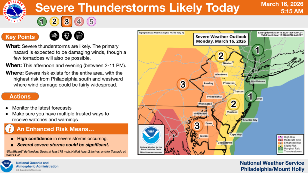
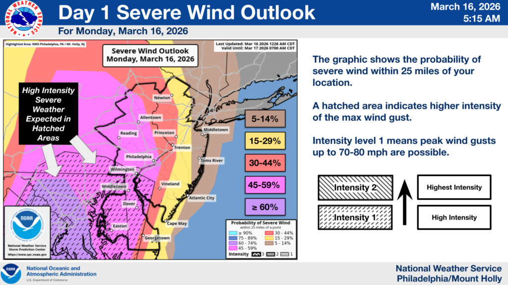
The National Weather Service predicts high probability of severe weather this afternoon and evening with potential to cause widespread wind damage throughout the forecast area, especially from around Philadelphia and extending west and southward.
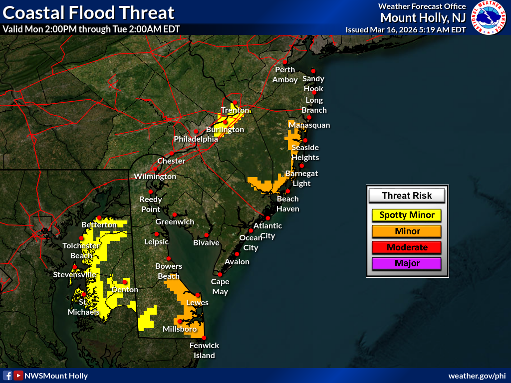
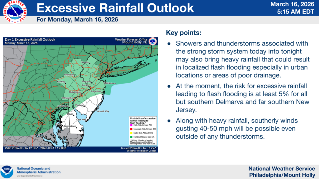
Multiple rounds of showers and embedded thunderstorms are expected to develop this afternoon and evening, along with strong southerly winds. Some of these storms could be severe, but the threat for more widespread significant severe weather will be mainly in the evening period as a line of storms moves through from west to east along a strong cold front. Severe storms are defined by wind gusts of at least 75MPH or EF2 tornadoes. Flash floods are also possible.
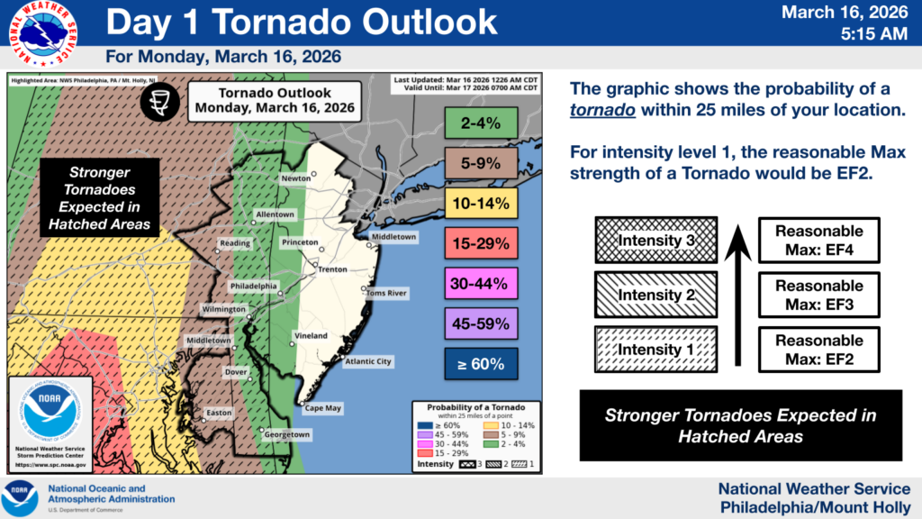
While the probability of flash floods or tornadoes in our area is only around 5-10%, residents are encouraged to monitor local news and weather alerts. The next update from the National Weather Service will be issued by 4pm today.
The National Weather Service and Bucks County Emergency Management Agency will have more up-to-date information, and residents can sign up for Ready Bucks to receive emergency notifications. While the Borough will do its best to ensure updates are shared with residents on our website and Facebook page as soon as possible, we should not be considered the primary source for weather-related updates.
See the following graphics from NWS for more information.